Release
Type - This
field indicates how the emissions exit out to the atmosphere and
generally all
points or areas at which emissions are released to the atmosphere
(environment)
via a stack or fugitive release. A “release point” can define the area
over
which fugitive emissions occur.
Additional fields are displayed at the bottom of the
screen based on the type chosen. Those type specific fields are described with each of five options as described
below:
Fugitive Area - This type of egress is typically
associated with storage piles, roadways and parking areas and surface
mining; pollutants are emitted near ground level and are emitted
homogenously.
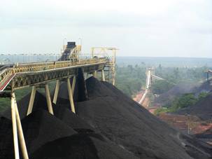
Fugitive Area Specific Parameters
Area Source Dimensions (length, width, release height)
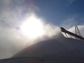
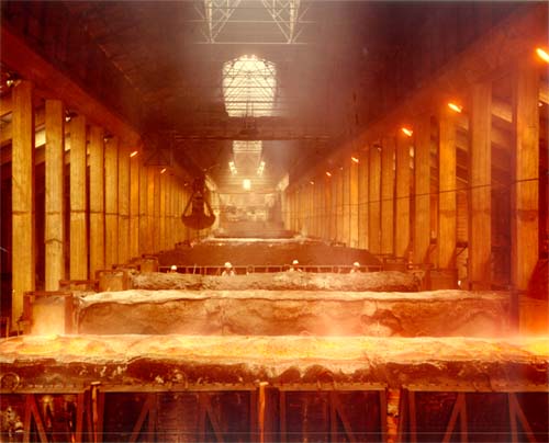
- Averages can be used. For irregular surfaces such as storage
piles (see first picture below), enter
dimensions of an average cross section; height is entered as half of
the maximum pile height (½ highest point of height is from the ground).
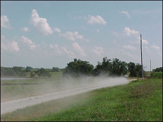
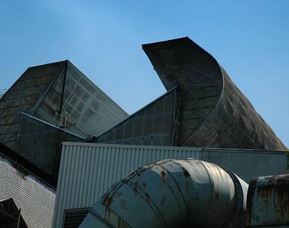
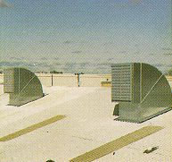
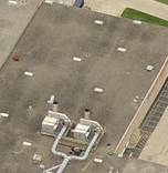
An open fugitive source characterized as a horizontal area (LxW) with a
release height (see second picture below).
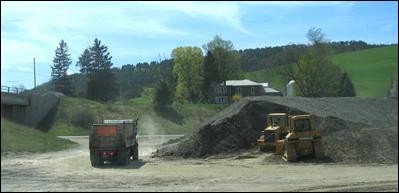
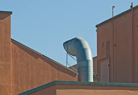
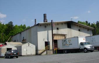
For process sources such as crushers, use the
process opening (e.g., area of crusher hopper opening) and ignore
material handling and storage emissions points. A roadway or parking
area dimension always uses zero as the height (see third picture below).
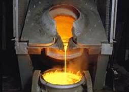
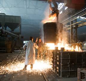
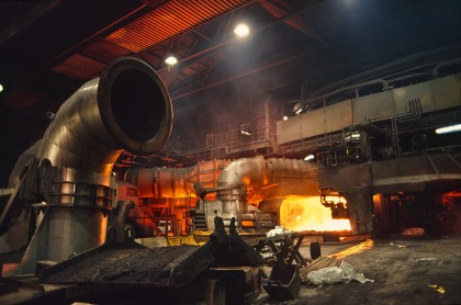
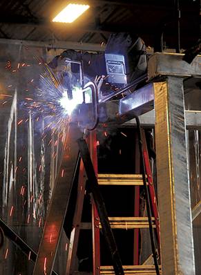
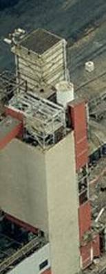
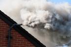
Fugitive Volume - This egress of source is typically
associated with emissions at transfer points, or in buildings that are
not routed to a stack. Emissions occur over a certain area and within a
certain depth of space. For example, smelting, conveyor transfer
points, or cutting and welding.
Fugitive Volume Specific Parameters
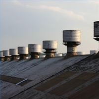
Volume Source Dimensions (width, height, release height)
- An unpowered vertical opening, such as a window or roof monitor,
characterized as a vertical area (WxH) with a release height, measured
at the midpoint of the opening. Multiple openings in a building may be
averaged, if necessary.
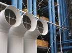
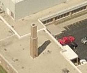
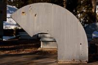
Stack Horizontal - This type of egress is very common. It
is typically either round or square and can be small or very large.
Horizontal stacks are usually mounted on the roof, protruding
vertically but then bending ninety degrees not far from the surface of
the roof so that the emissions exit horizontal to the ground.
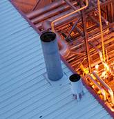
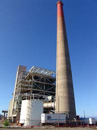
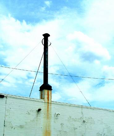
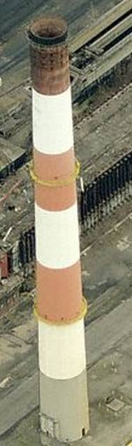
Stack Vertical - this type of egress is the most common
type and is easily identifiable. It is typically either round or square
and can be small or very large. Vertical stacks can be mounted on the
roof and some are free-standing.
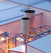
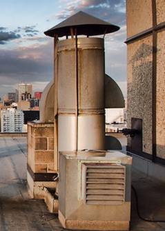
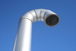
Stack Vertical Obstructed - Typical obstructions include
rain caps or diffusers
Stack (Horizontal, Vertical or Vertical Obstructed) Specific Parameters
Shape
- Indicate the shape of the opening of the stack to the ambient air
(square, rectangle, round, other). The options are listed below
with
examples:
Square
Round
Other - Examples include goose neck,
downward-facing vent, etc.
Diameter (ft) – Diameter of the stack opening if the opening is round
Cross Sectional Area (square ft) – “surface” area of the stack opening if the opening is square or rectangular
Temp At Max. Oper (F) – Maximum expected temperature of the air flow exiting the stack, in degrees farenheight
Temp At Avg. Oper (F) – Average expected temperature of the air flow exiting the stack, in degrees farenheight
Flow At Max. Oper (acfm) – Maximum expected air flow exiting the stack
Flow At Avg. Oper (acfm) - Average expected air flow exiting the stack
CEM Data
– This area identifies any continuous emission monitors and/or opacity
monitors installed on the stack or ductwork leading to the stack and
provides the ability to identify the pollutant(s) measured by the
monitor(s). For egress points that have continuous emissions
monitor system(s) (CEMS), the CEM Data
section should be completed. To
add a CEMS, click the Add
CEM button and enter the monitor brand and
model into the input field. For example: Siemens Ultramat 6. Then click
the box under the appropriate pollutant(s) in which it measures in the Pollutant
Monitored column, placing a checkmark in the box(es). To
delete a CEMS, place a checkmark in the box in the Select
column to the
left of the CEMS you wish to delete and click the Delete Selected CEMs
button. To add additional CEMS click the Add CEM
button again and
follow previous steps. Once the CEMS information has been entered,
click Save.
Once saved, the CEMS list may be printed by clicking the Printable
View button or sent to Excel by clicking the Export to Excel
button.
Company
ID - The term you use to identify the egress
point.
Company
Description - This field should describe the
egress point (and may be the same as the “company ID”). It
can also include any explanations necessary regarding the data for
egress point.
Operating
Status - This field identifies whether the egress is used
and is typically “operating" if it's associated emissions unit is
permitted and not marked as “permanently shut down”.
Base Elevation (ft) - This field identifies the number of
feet the ground is above sea level . Usually this can be obtained from
topographic maps.
Fence Line Distance (ft) - The shortest distance between
the egress and public access to the egress. The distance can be zero if there is no
fence, wall, or other barrier (see the third picture below as an example). Fence line distance may be estimated (e.g.,
walked).
Release Height (ft) - The vertical distance from ground
level to where the emissions are released to the outside (ambient) air
(stack opening for stacks).